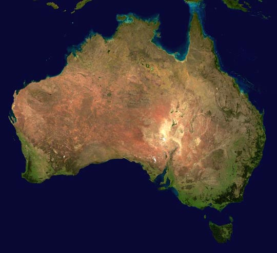
Satellite Photo of Australia
This satellite photo of Australia (taken by NASA) shows how dry the continent is in the middle. Once you get past the green edges, there's not much but desert. You can also see where the land bridge was between Australia and Papua New Guinea on the tip of Cape York Peninsula (top right). For more satellite photos and images of Australia, check out Google Local.
Satellite Photo of Australia